
Stir crazy has shopped around a lot of different faces in a lot of different ways this winter. Ears don’t need to be on the ground long to get that figured out. Folks talk and post.
Air BnB box-checkers and Sunday drivers are waiting on the dam to break or speed it up and set a few charges to get the foreign concept of wide open regularity flowing again.
Perhaps it’s taking the family to a restaurant, discovered years ago tucked off the depths of an eastbound two-lane headed toward Tybee Island.
Maybe it’s driving the low slung hills and curves toward Cashiers.
Those spring time multi-state loops helping clear heads and press reset from the throes of the damp and the cold – they’re needing us just about as bad as we need them right now.
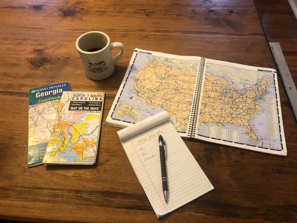
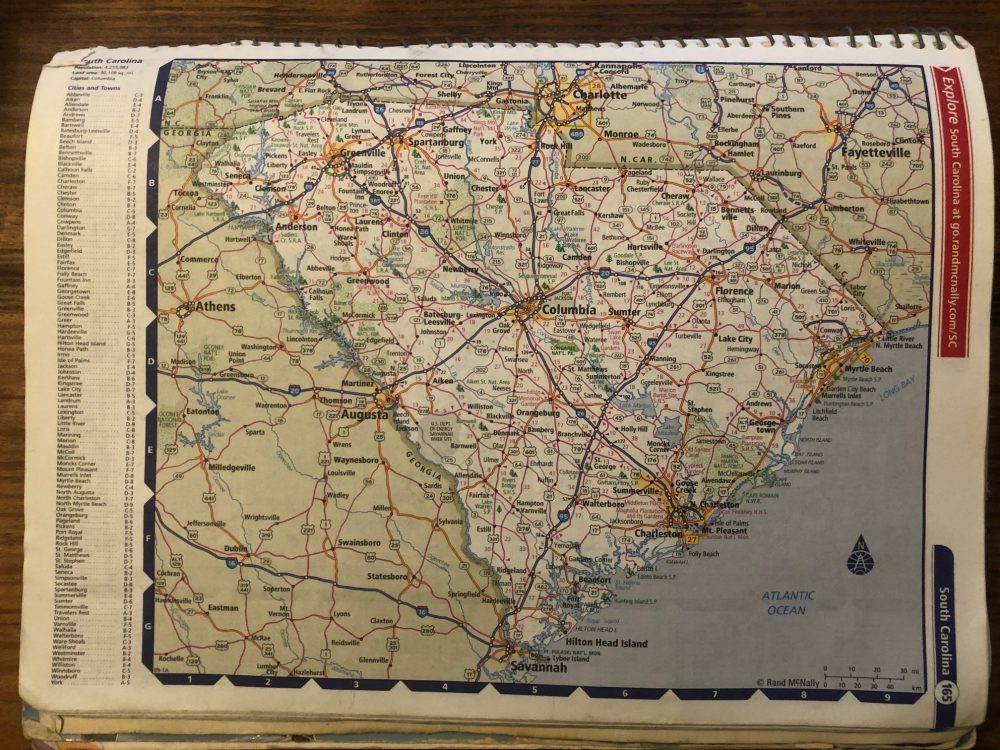
Planning those excursions often requires a general knowledge of direction, maybe a couple of predetermined stops along the way even. Lucky for us, the ever evolving need of navigational demand has birthed apps like Waze, Google Maps and countless other screen residents aiding our go. Those are real cool and everything, but its getting awfully close to making the US Road Atlas and the regional fold-up map read like a couple old lost tablets of Sanskrit.
While reading the Bernstein Bears short story to my daughter titled Too Much Car Trip, I was struck by the revelation that maps and road atlases have the potential to twist up brains stuck on digital dependancy.
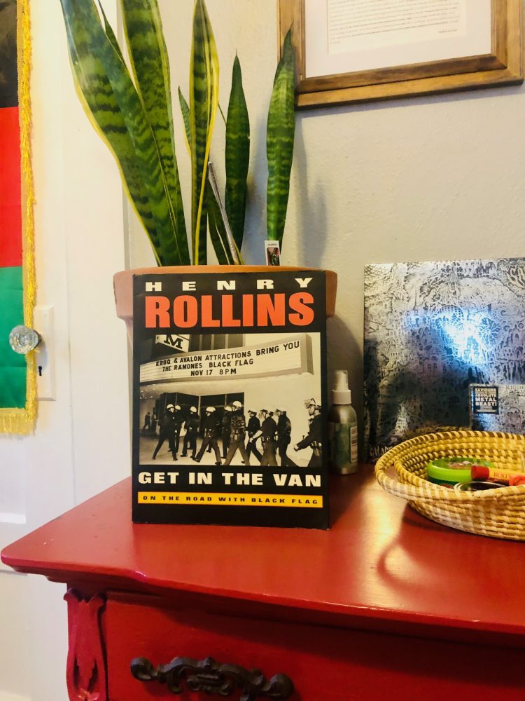
Those folded or spiraled one-time essentials were just as common as gas in the tank for eras of the not so distant past. Everyone from your Mom to touring bands like Black Flag depended on theirs.
Maps are more than just a trail to the keys of charming rentals or another packed venue; they’re a cheap and wonderful educational distraction. They are conversation starters. Rarely are they of much mention or deemed mainstay travel companions today, thanks to technical convenience. However, there’s some real high value to be found in the manual rudiments of plotting.
At first glance a real sense of intimidation can cross a set of fresh eyes. Zig zags this way, that way. Legends full of scale, charts, and identifiers pock pages with some pretty microscopic print reading like alphabetic and numeric salad. Zoomed-in blocks of a city’s details like Atlanta leave little room for error when making snap exit calls at 2:00 in the morning when not being prompted by an app.
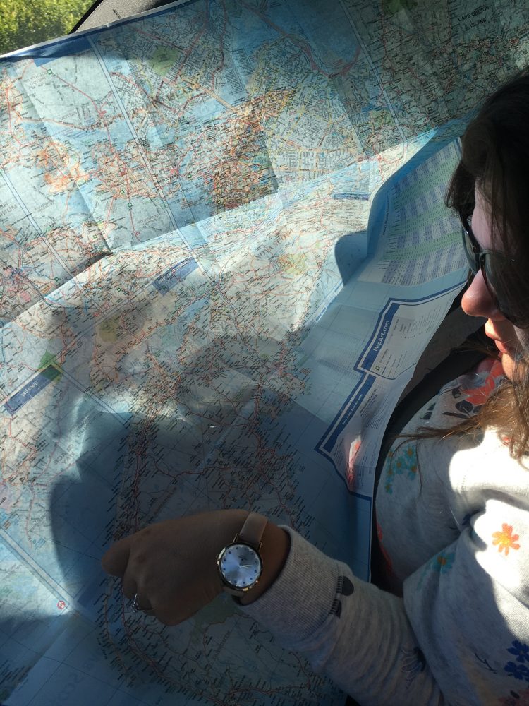
As a young man, myself and a revolving cast of traveling partners relied on these maps as much as we relied on fourteen hours worth of chewing tobacco getting us from A to B.
Getting on bulls and traveling to rodeos across the United States was our full ride to a Bachelor’s Degree in North American Geography. They became a way to collectively learn the places around us here at the house and where we had to go when it was time to get in the van. They forced our hands at planning. They helped get teenage boys without parents to Flying J truck centers or 24-hour WaWa’s across the U.S. to ring home and confirm their sons made it to Tulsa or Philadelphia in one piece. (Sorry for the sleepless nights, Mama.)
Wal-Mart parking lots, diners and our parent’s living rooms all got used to route multi-state adventures keeping those gold buckle dreams alive. If time permitted and some free local attraction seemed cool to us, it might get built into pit stops, but not always. Most US Road Atlases come complete with state feature pages showcasing their goods and points of interest.
Publisher Rand McNally offers these, ranging from fifteen to thirty dollars today, and can easily be found at most book or big- box stores.
Calculating the distance in hours taught us structure – it showed us a little time management. Shorthand, tallies, additions, subtractions and nonsense all found its way to our margins with various colors of ink. That note taking and nonsense let memories sync back up 15 years later when possessions of a past life were unboxed in a move.
While a window mounted GPS or Waze app would have been a sure welcome to us, learning those places and how to see America when it required a study and not a click was a real treat. The acres of discovery between those pages measure like one candle beside the sun.
Those towns, roads and ecosystems of different regions can offer limitless learning and teaching points to us and our loved ones. If anything, maps promote seeing a bigger picture and hold our legwork accountable. There is a simple and pure magic evoked when tracing those highway lines with a finger, then landing on a destination.
Developing new skillsets or cleaning up old ones has a way of channeling our good. Instead of plugging in an address this spring, grab a map or Atlas and plot your way.
It is sure to get some questions going around the table or deck. Plotting and planning will give families mutual responsibility when divvied up on long drives and is a great way to casually learn a little bit more about this big piece of land we share.


